Background
After reading for an HND in Conservation Sciences at Dorset Institute of Higher Education and a BA in Archaeology at the University of Southampton, Peter supervised an archaeological excavation on an important medieval site in Oslo, Norway.
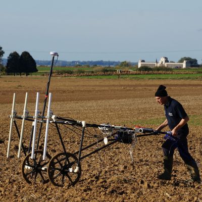
Returning to the UK, he worked for East Sussex County Council and North Hertfordshire District Council Museum Services before joining Northamptonshire County Council. He was employed by Northamptonshire County Council to assist with the English Heritage funded landscape project, the Raunds Area Survey. At this time Peter developed the interest in the application of geophysical surveys to archaeological sites and expanded this service on a commercial and research basis. In 2002, Peter joined a private company, Pre-Construct Geophysics, which provided an archaeological geophysics service for archaeologists and developers alike.
Peter joined Cranfield University in 2006 as a research fellow and has established the commercial and research arm of the department in geophysics.
Current activities
His current research is in Conflict Archaeology and has been working on the First World War archaeology in Belgium and on Salisbury Plain where the soldiers during the Great War dug practice trenches prior to deployment to the frontline in France and Belgium.
Peter has also been carrying out research on detecting mass graves on historic battlefields in England. These are Wars of the Roses and the English Civil War. He has also been looking at battlefield features such as siege works and other fortifications. In 2009, Peter became a part-time panel tutor at the Institute of Continuing Education, Cambridge University. In that year, he taught a Diploma course entitled Conflict Archaeology: case studies from 20th century Europe with his co-tutor, Dr Gilly Carr.
He is also a guest lecturer at Keele and Lincoln Universities in Historical and Military Geoscience and the Introduction to Archaeology short course respectively. Peter is a current committee member on the Forensic Archaeology Special Interest Group Expert Panel, Institute for Archaeologists.
Peter is also engaged in community archaeology and training local groups in the techniques of geophysics, in particular magnetometry and resistivity.
Clients
Defence Infrastructure Organisation
Oxford Archaeology East (OAEast)
Pre-Construct Archaeology Ltd
Environment Agency
CLASP
The National Trust
English Heritage
Nottinghamshire County Council
The Flemish Institute, Belgium
Ghent University
Battlefields Trust
West Midlands Police
States of Jersey Police
Publications
Articles In Journals
- Pottage K, Masters P & Márquez-Grant N. (2025). Redefining the documentation of outdoor surface scatter scenes using geographic information systems. Journal of Forensic Sciences, 70(2)
- Pawlett M, Girkin NT, Deeks LK, Evans DL, Sakrabani R, .... (2024). The contribution of natural burials to soil ecosystem services: review and emergent research questions. Applied Soil Ecology, 194
- Georgiou A, Masters P, Johnson S & Feetham L. (2022). UAV-assisted real-time evidence detection in outdoor crime scene investigations. Journal of Forensic Sciences, 67(3)
- Masters P & Osgood R. (2021). Towards an integrated approach to recording military aircraft crash sites. Archaeological and Environmental Forensic Science, 2(1)
- Lockwood E & Masters P. (2021). Application of viewshed analysis and probability mapping for search area determination based on the Moors murders on Saddleworth Moor, the United Kingdom. Journal of Forensic Sciences, 66(5)
- Evers R & Masters P. (2018). The application of low-altitude near-infrared aerial photography for detecting clandestine burials using a UAV and low-cost unmodified digital camera. Forensic Science International, 289
- Masters P. (2016). Geophysics of Lager Wick forced labour camp, Grouville, Jersey, Channel Islands. Journal of Conflict Archaeology, 11(2-3)
- De Clercq W, De Smedt P, De Reu J, Herremans D, Masters P, .... (2012). Towards an Integrated Methodology for Assessing Rural Settlement Landscapes in the Belgian Lowlands. Archaeological Prospection, 19(2)
- Juerges A, Pringle JK, Jervis JR & Masters P. (2010). Comparisons of magnetic and electrical resistivity surveys over simulated clandestine graves in contrasting burial environments. Near Surface Geophysics, 8(6)
- Mota R & Monteiro Santos FA. (2010). 2D sections of porosity and water saturation from integrated resistivity and seismic surveys. Near Surface Geophysics, 8(6)
- Masters P & Stichelbaut B. (2009). From the air to beneath the soil – revealing and mapping great war trenches at Ploegsteert (Comines‐Warneton), Belgium. Archaeological Prospection, 16(4)
Conference Papers
- Masters P & Cooper G. (2017). Built to last: Building a magnetometer cart - Advantages and disadvantages in the construction of a bespoke system
- Masters P. (2017). Ripples in the sand: locating a complete aircraft in the inter-tidal zone
- Pringle JK, Cassella JP, Williams A, Cross P, Ruffell A, .... (2013). Collaborative Geophysical Monitoring of Simulated Forensic 'Crime Scenes’ in the U.K.
Books
- Masters P. (2018). Chapter 4 – Geophysical Survey 2010: Necropolis and Town In Tzedakis Y, Martlew H & Arnott R (eds), The Late Minoan III Necropolis of Armenoi I: Introduction and Background (Volume 1. Introduction and Background). INSTAP Academic Press.
- Masters P. (2016). Chaper 3. Contested landscape: La Boisselle and the glory hole In Stichelbaut B & Cowley D (eds), Landscapes and Archaeology from Above. Routledge.
- Masters P. (2016). Contested landscape: La Boisselle and the glory hole In Conflict Landscapes and Archaeology from Above.
- Masters P. (2009). Not all who wander are lost (Chapter 4 - Finding the front) In Osgood R & Brown M (eds), Digging up Plugstreet: The Archaeology of a Great War Battlefield. Haynes Publishing UK.