Contact Dr Toby Waine
- Tel: +44 (0) 1234 754118
- Email: t.w.waine@cranfield.ac.uk
- ORCID
Background
Dr Toby Waine is an agricultural engineer with a farming background. He completed his EngD in Non-invasive soil property measurement for precision farming at Cranfield University in 1999. After, he helped to commercialise an electromagnetic induction (EMI) based soil property sensor investigated during his doctorate project while working as the Technical Manager for an IT-agronomy company. For the next three years Dr Waine gained further commercial IT experience, firstly working as a Software Engineer, then European Technical Sales Engineer for a leading mobile phone software company. Keen to contribute to better understanding of agricultural production systems, he returned to academia in 2004 to focus on the application of remote sensing and geographical information systems for land resources monitoring. Particular areas of interest are the integration of multi-spectral satellite imagery of different spatial resolutions within the context of crop survey design and crop production estimates. Dr Waine lectures on the MSc Advanced GIS and Remote Sensing (formerly Geographical Information Management), a course developed in collaboration with industry to provide a balanced coverage of GIS, remote sensing and spatial data analytics.
Current activities
Dr Waine's research can be grouped into 2 main themes:
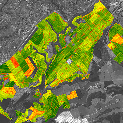
Land resources monitoring for crop inventory: Dr Waine has extensive experience in land use/cover monitoring where remote sensing technology is integrated with existing data sets to provide local, regional or national inventories. From measuring illicit opium production in Afghanistan to undertaking national assessments of vegetation in semi-arid climates, innovative use of remote sensing remains a key theme in both his research and consultancy work. An example of specific expertise is in developing and supporting operational methods for vegetation monitoring and providing robust, statistically-based area estimates of land cover and net primary production. Dr Waine has developed novel ways of defining land cover typologies and classification schemes for optimising classification accuracy.
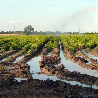
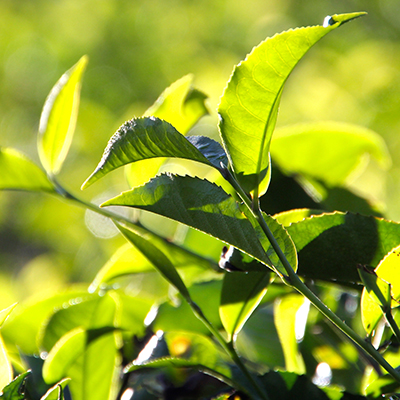
Food security, through the application of remote sensing to Precision Agriculture: Dr Waine's focus is remote sensing of crops for canopy management and yield prediction. This involves understanding differences in spatial and temporal scale, and exploiting the advantages of each in combination with other datasets. An example is the 'FarmingTruth' feasibility study with the European Space Agency which is evaluating the commercial and technical viability of a new precision agriculture service based on the fusion of data from field-based soil and nutrient measurements with remotely sensed multi-spectral images. This service will allow growers to more accurately target inputs (e.g. fertilisers) whilst reducing waste and environmental impact. This research theme will focus on developing models and techniques to fully exploit the underlying variation of nutrients, water and soil. Many existing practices are out-dated and over-simplistic. Therefore the aim is to build a new paradigm so that fields are managed in a way that reflects their variability (e.g. in soil properties) over space and time.
Clients
- Department for Energy Security and Net Zero
- Biotechnology and Biological Sciences Research Council
- Natural Environment Research Council
- United Nations
- Foreign & Commonwealth Development Office
- Innovate UK
- European Space Agency
- Unilever PLC
- Terravesta Energy Limited
- Ecom Agroindustrial Corp. Limited
- Lipton Teas and Infusions B.V.
Publications
Articles In Journals
- Müller R, Okokhere‐Edeghoghon B, Janowicz NJ, Bond AD, Kociok‐Kohn G, .... (2025). Transparent, sprayable plastic films for luminescent down‐shifted‐assisted plant growth. Advanced Materials Technologies, 10(6)
- El Fartassi I, Milne AE, Metcalfe H, El Alami R, Diarra A, .... (2025). An agent-based model of farmer decision making: application to shared water resources in Arid and semi-arid regions. Agricultural Water Management, 310
- Sultana MS, Waine TW, Bari N & Tyrrel SF. (2025). Assessing the reliability of open-source data used for spatial characterisation of urban sanitation infrastructure—a field study in Rajshahi, Bangladesh. Environmental Science and Pollution Research, 32(13)
- Sultana MS, Waine TW, Bari N & Tyrrel SF. (2025). An analysis of factors that influence the spatial pattern of faecal matter flow in unsewered cities. Science of The Total Environment, 978
- El Fartassi I, Milne AE, Oulaid B, Bezrhoud Y, Metcalfe H, .... (2025). Trade-offs associated with changing cropping patterns in semi-arid areas of Morocco. Science of The Total Environment, 979
- Sultana MS, Waine TW, Bari N & Tyrrel SF. (2025). Sanitation infrastructure and faecal flow – SanIFFlow: a spatial mapping tool for integrated planning and management of sanitation in unsewered urban areas. Geomatica, 77(1)
- Wiltshire C, Meersmans J, Waine TW, Grabowski RC, Addy S, .... (2025). Understanding organic carbon dynamics in a river catchment through improved sediment fingerprinting. CATENA, 258
- Sultana MS, Waine T, Bari N & Tyrrel S. (2025). Corrigendum to “Sanitation infrastructure and faecal flow – SanIFFlow: A spatial mapping tool for integrated planning and management of sanitation in unsewered urban areas” [Geomatica 77 (2025) 100059]. Geomatica, 77(1)
- Hu J, Xie Y, Ban X, Zhang L, Zhou Z, .... (2025). Active chlorophyll fluorescence technologies in precision weed management: overview and perspectives. Agriculture, 15(16)
- El Fartassi I, Metcalfe H, El Alami R, Diarra A, Alonso-Chavez V, .... (2025). Adaptations in agricultural water management in arid regions: modelling farmer behaviour and cooperation on irrigation sustainability in Morocco. Agricultural Water Management, 319
- Oulaid B, Milne AE, Waine TW, El Alami R, Rafiqi M, .... (2024). Stepwise model parametrisation using satellite imagery and hemispherical photography: tuning AquaCrop sensitive parameters for improved winter wheat yield predictions in semi-arid regions. Field Crops Research, 309
- Wiltshire K, Meersmans J, Waine TW, Grabowski RC, Thornton B, .... (2024). Evaluating erosion risk models in a Scottish catchment using organic carbon fingerprinting. Journal of Soils and Sediments, 24(8)
- Knight C, Khouakhi A & Waine TW. (2024). The impact of weather patterns on inter-annual crop yield variability. Science of The Total Environment, 955
- Simms DM, Hamer AM, Zeiler I, Vita L & Waine TW. (2023). Mapping agricultural land in Afghanistan’s opium provinces using a generalised deep learning model and medium resolution satellite imagery. Remote Sensing, 15(19)
- Cudjoe D, Virlet N, Castle M, Riche AB, Mhada M, .... (2023). Field phenotyping for African crops: overview and perspectives. Frontiers in Plant Science, 14
- El Fartassi I, Milne AE, El Alami R, Rafiqi M, Hassall KL, .... (2023). Evidence of collaborative opportunities to ensure long-term sustainability in African farming. Journal of Cleaner Production, 392(March)
- Wiltshire C, Waine TW, Grabowski RC, Meersmans J, Thornton B, .... (2023). Assessing n-alkane and neutral lipid biomarkers as tracers for land-use specific sediment sources. Geoderma, 433(May)
- Sultana MS, Waine TW, Bari N & Tyrrel SF. (2023). Towards a new spatial representation of faecal sources and pathways in unsewered urban catchments using open-source data. Journal of Water, Sanitation and Hygiene for Development, 13(4)
- Khouakhi A, Driouech F, Slater LJ, Waine TW, Chafki O, .... (2022). Atmospheric rivers and associated extreme rainfall over Morocco. International Journal of Climatology, 42(15)
- Mcilwaine B, Rivas Casado M & Waine TW. (2022). Investigating optimal unmanned aircraft systems flight plans for the detection of marine ingress. International Journal of Applied Earth Observation and Geoinformation, 108(April)
- Wiltshire C, Glendell M, Waine TW, Grabowski RC & Meersmans J. (2022). Assessing the source and delivery processes of organic carbon within a mixed land use catchment using a combined n-alkane and carbon loss modelling approach. Journal of Soils and Sediments, 22(5)
- Hamer AM, Simms DM & Waine TW. (2021). Replacing human interpretation of agricultural land in Afghanistan with a deep convolutional neural network. International Journal of Remote Sensing, 42(8)
- Beale J & Waine TW. (2021). A method to assess the performance of SAR-derived surface soil moisture products. IEEE Journal of Selected Topics in Applied Earth Observations and Remote Sensing, 14
- Ferracci V, Bolas CG, Freshwater RA, Staniaszek Z, King T, .... (2020). Continuous isoprene measurements in a UK temperate forest for a whole growing season: effects of drought stress during the 2018 heatwave. Geophysical Research Letters, 47(15)
- Vavlas N-C, Waine TW, Meersmans J, Burgess PJ, Fontanelli G, .... (2020). Deriving wheat crop productivity indicators using Sentinel-1 time series. Remote Sensing, 12(15)
- Hamer A, Simms D & Waine T. (2020). Using deep learning to transfer knowledge between satellite datasets for automated agricultural land discrimination in Afghanistan.
- Beale J, Waine T, Corstanje R & Evans J. (2020). A performance assessment method for SAR satellite-derived surface soil moisture data using a soil-water balance model, meteorological observations, and soil pedotransfer functions..
- Vavlas N-C, Waine T, Meersmans J & Richter G. (2020). Winter wheat growth dynamics and their relationship with the field productivity using Sentinel-1 SAR polarimetry.
- Wiltshire K, Waine T, Grabowski B, Glendell M, Addy S, .... (2020). Sediment origins across the terrestrial-aquatic continuum: climate threat mitigation and promotion of water quality.
- Bannister D, Orr A, Jain SK, Holman IP, Momblanch A, .... (2019). Bias correction of high-resolution regional climate model precipitation output gives the best estimates of precipitation in Himalayan catchments. Journal of Geophysical Research: Atmospheres, 124(24)
- Snapir B, Waine TW & Biermann L. (2019). Maritime vessel classification to monitor fisheries with SAR: demonstration in the North Sea. Remote Sensing, 11(3)
- Snapir B, Momblanch A, Jain SK, Waine TW & Holman IP. (2018). A method for monthly mapping of wet and dry snow using Sentinel-1 and MODIS: Application to a Himalayan river basin. International Journal of Applied Earth Observation and Geoinformation, 74
- Campbell S, Simmons RW, Rickson RJ, Waine TW & Simms DM. (2018). Using Near-Surface Photogrammetry Assessment of Surface Roughness (NSPAS) to assess the effectiveness of erosion control treatments applied to slope forming materials from a mine site in West Africa. Geomorphology, 322
- Vandrol J, Rivas Casado M, Blackburn K, Waine TW, Leinster P, .... (2018). In-channel 3D models of riverine environments for hydromorphological characterization. Remote Sensing, 10(7)
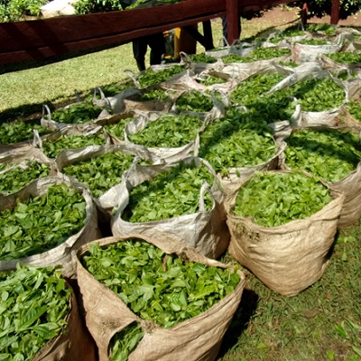
- Snapir B, Waine TW, Corstanje R, Redfern SP, De Silva J, .... (2018). Harvest monitoring of Kenyan tea plantations with X-band SAR. IEEE Journal of Selected Topics in Applied Earth Observations and Remote Sensing, 11(3)
- Albugami S, Palmer S, Meersmans J & Waine TW. (2018). Evaluating MODIS dust-detection indices over the Arabian Peninsula. Remote Sensing, 10(12)
- Whetton RL, Waine TW & Mouazen AM. (2018). Hyperspectral measurements of yellow rust and fasarium head blight in cereal crops: Part 2: On-line field measurement. Biosystems Engineering, 167
- Whetton RL, Waine TW & Mouazen AM. (2018). Evaluating management zone maps for variable rate fungicide application and selective harvest. Computers and Electronics in Agriculture, 153
- Simms DM, Waine TW & Taylor JC. (2017). Improved estimates of opium cultivation in Afghanistan using imagery-based stratification. International Journal of Remote Sensing, 38(13)
- Snapir B, Simms DM & Waine TW. (2017). Mapping the expansion of galamsey gold mines in the cocoa growing area of Ghana using optical remote sensing. International Journal of Applied Earth Observation and Geoinformation, 58
- Corstanje R, Mercer TG, Rickson JR, Deeks LK, Newell-Price P, .... (2017). Physical soil quality indicators for monitoring British soils. Solid Earth, 8(5)
- Whetton RL, Hassall KL, Waine TW & Mouazen AM. (2017). Hyperspectral measurements of yellow rust and fusarium head blight in cereal crops: Part 1: Laboratory study. Biosystems Engineering, 166
- Mouazen AM, Waine TW & Whattoff D. (2017). A multi sensor data fusion approach for creating variable depth tillage zones. Advances in Animal Biosciences, 8(2)
- Simms DM, Waine TW & Taylor JC. (2017). Improved estimates of opium cultivation in Afghanistan using imagery-based stratification.
- Simms DM, Waine TW, Taylor JC & Brewer TR. (2016). Image segmentation for improved consistency in image-interpretation of opium poppy. International Journal of Remote Sensing, 37(6)
- Whetton R, Waine TW & Mouazen AM. (2016). Optimising configuration of a hyperspectral imager for on-line field measurement of wheat canopy. Biosystems Engineering, 155
- Waine TW, Simms DM, Taylor JC & Juniper GR. (2014). Towards improving the accuracy of opium yield estimates with remote sensing. International Journal of Remote Sensing, 35(16)
- Simms DM, Waine TW, Taylor JC & Juniper GR. (2014). The application of time-series MODIS NDVI profiles for the acquisition of crop information across Afghanistan. International Journal of Remote Sensing, 35(16)
- Mouazen AM, Alhwaimel SA, Kuang B & Waine T. (2014). Multiple on-line soil sensors and data fusion approach for delineation of water holding capacity zones for site specific irrigation. Soil and Tillage Research, 143
- Snapir B, Hobbs S & Waine TW. (2014). Roughness measurements over an agricultural soil surface with Structure from Motion. ISPRS Journal of Photogrammetry and Remote Sensing, 96
- Taylor JC, Waine TW, Juniper GR, Simms DM & Brewer TR. (2010). Survey and monitoring of opium poppy and wheat in Afghanistan: 2003-2009. Remote Sensing Letters, 1(3)
- James IT, Waine TW, Bradley RI, Taylor JC & Godwin RJ. (2003). Determination of Soil Type Boundaries using Electromagnetic Induction Scanning Techniques. Biosystems Engineering, 86(4)
- Earl R, Taylor JC, Wood GA, Bradley I, James IT, .... (2003). Soil Factors and their Influence on Within-field Crop Variability, Part I: Field Observation of Soil Variation. Biosystems Engineering, 84(4)
- Pahl O, Godwin RJ, Hann MJ & Waine TW. (2001). SW—Soil and Water. Journal of Agricultural Engineering Research, 80(4)
Conference Papers
- Cudjoe DK, Okyere FG, Virlet N, Castle M, Buchner P, .... (2023). Using proximal sensing parameters linked to the photosynthetic capacity to assess the nutritional status and yield potential in quinoa
- Wiltshire C, Waine TW, Grabowski RC, Glendell M, Thornton B, .... (2022). Assessing the source and delivery of organic carbon at a catchment scale using a combined sediment fingerprinting and carbon loss modelling approach
- Khouakhi A, Driouech F, Slater LJ, Waine TW, Chafki O, .... (2021). Extreme weather associated with atmospheric rivers over Morocco
- Beale J, Waine TW, Corstanje R & Evans J. (2021). Improved soil moisture estimation with Sentinel-1 for arable land at the field scale
- Wiltshire C, Glendell M, Waine TW, Grabowski RC, Thornton B, .... (2021). From field to stream: Tracing streambed organic carbon origins at a catchment scale
- Simms DM & Waine TW. (2016). Opium yield estimates in Afghanistan using remote sensing
- Mouazen AM, Alhwaimel SA, Kuang B & Waine TW. (2013). Precision agriculture '13
- James IT, Waine TW, Bradley RI, Godwin RJ & Taylor JC. (2000). A comparison between traditional methods and EMI scanning for determining soil textural boundaries
- Waine TW, Blackmore BS & Godwin RJ. (2000). Mapping available water content and estimating soil textural class using electro-magnetic induction.