Become a highly skilled and sought-after professional in geospatial data science
Sustainable use or conservation of the earth's resources requires the organisation, utilisation and integration of technologies such as database management, image processing and digital cartography, to ensure provision of high quality, reliable and up-to-date information. The Advanced GIS and Remote Sensing master’s (previously known as Geographical Information Management) is a unique and innovative course that has been developed in direct collaboration with industry and in response to the increased global demand for multi-disciplinary managers, advisors and consultants in resource management. Taught by leading academic experts, this course is unique in providing balanced coverage of the key GIS technologies to prepare you for a successful career in the rapidly growing geospatial sector.Overview
- Start dateFull-time: October, part-time: October
- DurationOne year full-time, two-three years part-time
- DeliveryTaught modules 80 credits/800 hours, Group projects 40 credits/400 hours, Individual project 60 credits/600 hours
- QualificationMSc, PgDip, PgCert
- Study typeFull-time / Part-time
- CampusCranfield campus
Who is it for?
We welcome students from a variety of backgrounds who have a passion for technology and data. We bring together students who want to understand their role in sustainability and the new global economy, to solve real-world problems and make a positive global impact. You will gain experience of world-class spatial problem solving, as well as developing a range of personal and leadership skills to set you on the path for a rewarding career in any one of the growing range of industrial and research sectors that now routinely make use of geospatial information to solve global challenges.
Your career
Successful students develop diverse and rewarding careers in the spatial information industry, national and local government, consultancies, utilities, and research organisations. The international nature of this course means that career opportunities are not restricted to the UK. Cranfield graduates develop global careers and this course is internationally recognised by employers across the scientific, industrial and educational communities. Our practical and industry-led education makes our graduates some of the most desirable in the world for global employers to recruit.
The course is designed in direct collaboration with industry to provide you with the knowledge and practical skills to prepare you for a successful career across the full range of global sectors, including:
Environmental management, Natural resource management, Urban planning, Transportation planning, Emergency management, Science, Government and Business intelligence.
Our successful graduates who are highly skilled and sought-after professionals have pursued or enhanced their careers in a variety of key roles such as:
Data Scientist, Academic Researcher, GIS Technician, Geospatial Analyst, GIS Officer, Project Development Officer and Remote Sensing Scientist, at organisations such as Airbus and Cambridgeshire Acre.
Cranfield Careers and Employability Service
Cranfield’s Career Service is dedicated to helping you meet your career aspirations. You will have access to career coaching and advice, CV development, interview practice, access to hundreds of available jobs via our Symplicity platform and opportunities to meet recruiting employers at our careers fairs. Our strong reputation and links with potential employers provide you with outstanding opportunities to secure interesting jobs and develop successful careers. Support continues after graduation and as a Cranfield alumnus, you have free life-long access to a range of career resources to help you continue your education and enhance your career.
Cranfield supports international students to work in the UK after graduation
I chose Cranfield because of the academic excellence in my course – it's highly regarded in and around the UK and so are its links with industries.
My time at Cranfield prepared me for my current job in a variety of ways. Directly, group projects and working within a team of people who challenge your ideas and viewpoints is infinitely applicable in the work place. Indirectly, the heavy workload prepared me for balancing various projects in the workplace, developing my time management and communication skills.
There are students that are coming up with ideas that I would never have thought of and I know that businesses who we collaborate with would never have thought of. So it’s really important to get idea generation, to get motivations and to get people engaged in what businesses need today.
The assignments have good challenges for each student so we gain more knowledge and information. My group project is tracking precision nutrient management and using different kinds of GIS technology - that case study was in Kenya.
Why this course?
Advanced GIS and Remote Sensing is an exciting and rapidly growing branch of information technology (IT), incorporating and integrating satellite remote sensing, aerial photography and other spatial data, such as soil survey information, to derive reliable and up-to-date information which is essential for the sustainable use or conservation of the earth’s resources. This course will equip you with the skills and knowledge to develop an exciting career helping to address global issues in the geospatial sector.
Benefit from a practical approach to learning, gaining skills in geographical information systems, spatial analysis, machine learning, coding, image processing, remote sensing, data visualisation and cartography, and data science for a successful career in the rapidly expanding geospatial field.
You will also:
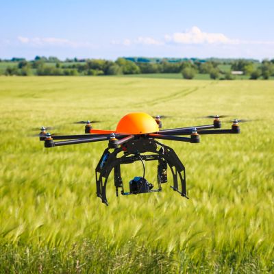
- Gain experience in the collection and processing of a wide range of geospatial data from satellite, manned and unmanned aircraft, and field survey, including processing of high-volume data in the cloud.
- Focus on identifying problems and creating resilient and sustainable solutions through the selection and integration of appropriate technologies.
- Learn via a varied combination of lectures, tutorials, real-world case studies and practical sessions led by Cranfield staff.
- You will gain practical, real-world experience through consultancy led individual and group projects, often supported by industry sponsors and focused on your personal interests and career aspirations.
- Apply the knowledge and skills that you learn on this course to issues such as climate change, improving farming yields, tropical deforestation, transportation, smart navigation systems, disaster response management, recreation, property management and telecommunications.
This master’s course is supported by our team of professional thought leaders, who have industry backgrounds and provide real-life learning challenges. Our teaching team are heavily involved in industrially funded research and development in digital environment, environmental monitoring, and resource survey. Our world leading research leads the course content and aligns it with the latest sector thinking. Our dedicated teaching team includes Professor Ronald Corstanje and Professor Stephen Hallett who are influential in the field of Environment and an integral part of this MSc. Our high student to staff ratio aims to deliver an excellent student experience and maximise your employability opportunities.
Informed by industry
The Advanced GIS and Remote Sensing MSc is designed to meet the relevant needs of global employers and benefits from a strong input from industry experts. This gives our students the confidence to know the course content aligns with the latest sector thinking and is beneficial to building a rewarding career.
- The applied GIS and related research our staff undertake is fed back into our GIS teaching programmes, ensuring all students who complete this MSc are equipped with cutting-edge expertise and skills.
- Double accreditation by The Royal Institution of Chartered Surveyors (RICS) and The Chartered Institution of Civil Engineering Surveyors (CICES) ensures that the course has been independently assessed as meeting current professional standards.
- Employers and partners ensuring that the MSc meets current industry demands for GI specialists include:
|
|
Course details
This course comprises eight modules, a group project and an individual project. Courses are not isolated from the real world and many are supported by research groups working on cutting-edge programmes.
Course delivery
Taught modules 80 credits/800 hours, Group projects 40 credits/400 hours, Individual project 60 credits/600 hours
Group project
The group project experience during the course is highly valued by both students and prospective employers. It provides you with the opportunity to take responsibility for a consultancy-type project while working under academic supervision. It also enables you to start building essential industry links and knowledge whilst studying.
The project involves the application and integration of component technologies:
- GIS
- GPS and remote sensing
- Field methods, and statistical analysis to produce quality-assured innovative solutions
Recent group projects include:
Individual project
The individual project is either industrially or University driven. You will be able to select the individual project in consultation with the course team and it will provide the opportunity to demonstrate independent research ability, the ability to think and work in an original way, contribute to knowledge, and overcome genuine challenges in relation to the management of the earth's resources. It also offers you the opportunity to work and build links with the types of organisation you will be seeking employment with on successful completion of the course.
Modules
Keeping our courses up-to-date and current requires constant innovation and change. The modules we offer reflect the needs of business and industry and the research interests of our staff and, as a result, may change or be withdrawn due to research developments, legislation changes or for a variety of other reasons. Changes may also be designed to improve the student learning experience or to respond to feedback from students, external examiners, accreditation bodies and industrial advisory panels.
To give you a taster, we have listed the compulsory and elective (where applicable) modules which are currently affiliated with this course. All modules are indicative only, and may be subject to change for your year of entry.
Course modules
Compulsory modules
All the modules in the following list need to be taken as part of this course.
GIS and Spatial Data Management
| Module Leader |
|
|---|---|
| Aim |
|
| Syllabus |
Spatial data models and database structures – vectors, rasters, topology, ordered and indexed lists, hierarchical, network, relational, object oriented, hybrid, metadata. |
| Intended learning outcomes |
On successful completion of this module you should be able to:
|
Aerial Photography and Digital Photogrammetry
| Module Leader |
|
|---|---|
| Aim |
Deriving digital elevation models and ortho imagery is an important application of remote sensing data for many areas of spatial work. This module introduces techniques for the extraction of topographic information from remotely sensed data using digital photogrammetry techniques. Image interpretation is also a vital skill required in many image based mapping projects. The concepts and techniques of image interpretation will be introduced and practised. |
| Syllabus |
|
| Intended learning outcomes |
On successful completion of this module you should be able to:
|
Scientific Python
| Module Leader |
|
|---|---|
| Aim |
|
| Syllabus |
Fundamentals of programming. |
| Intended learning outcomes |
On successful completion of this module you should be able to: Explain how computer code is used in science and engineering. Create Python code for solving set problems and develop confidence in writing code for your own projects. Analyse data using Python libraries and visualise results as graphs, maps and interactive figures. |
Applied Earth Observation
| Module Leader |
|
|---|---|
| Aim |
|
| Syllabus |
Physical principles:
|
| Intended learning outcomes |
On successful completion of this module you should be able to: Define the primary physical quantities that are directly related to measured radiance. Compare the nature of surface and atmospheric interactions with electromagnetic radiation between passive and active satellite sensors. Evaluate appropriate data for surface monitoring applications, considering how images are formed and the physical relations underlying the retrieval of satellite measured reflectance, temperature and backscattering coefficients. Analyse the complete remote sensing process from data reception to information extraction, including applying calibration and atmospheric correction methods to image data. |
Image Processing and Analysis
| Module Leader |
|
|---|---|
| Aim |
Extracting information from satellite, aerial and drone image data requires knowledge of a wide variety of image processing techniques. This module will give you the skills to select and apply appropriate image processing techniques for the extraction and analysis of information from image data for applications of remote sensing, for example in land use monitoring and surface change detection. |
| Syllabus |
Radiometric, spectral and spatial image enhancement: Contrast stretching (linear, bilinear, Gaussian, histogram equalisation and manual), digital filtering in the spatial domain (low-pass, high-pass, high-boost, median and directional). Band algebra: Derivation of soil and vegetation indices: ratios, normalised differences, PVI, SBI, tasselled cap concept. Geometric correction: Map projections, selection of ground control points, transform equations, resampling methods (nearest neighbour, bilinear interpolation, cubic convolution). Supervised and unsupervised image classification: Parametric and non-parametric techniques, clustering, segmentation, pixel and object-based approaches, machine learning, deep learning, and validation (accuracy assessment). Post processing, processing chains, change detection, cloud computing and applications. |
| Intended learning outcomes |
On successful completion of this module you should be able to: Evaluate a wide range of image processing techniques and their underlying mathematical principles. Select appropriate image processing sequences to achieve predetermined objectives. Operate and manage an image processing system. Integrate image processing techniques into applications of remote sensing. |
Advanced GIS Methods
| Module Leader |
|
|---|---|
| Aim |
GIS analyses are based upon increasingly sophisticated methods, but the results are subject to both error and uncertainty. A range of advanced methods are introduced that will have potential use to students in their group and thesis projects and their future careers. Emphasis will be given to the role of GIS in modelling environmental systems and the programming tools available to develop applications. |
| Syllabus |
|
| Intended learning outcomes |
On successful completion of this module you should be able to:
|
Environmental Resource Survey
| Module Leader |
|
|---|---|
| Aim |
This module covers the importance of environmental resource surveys that are required to obtain the data used in environmental information management. |
| Syllabus |
|
| Intended learning outcomes |
On successful completion of this module you should be able to:
|
Web Mapping
| Module Leader |
|
|---|---|
| Aim |
Geographical information is increasingly prevalent in our daily life, affecting personal leisure activities as much as the workplace. Geographical information represents a key theme in environmental management and, indeed, it has been estimated that some 80% of the data used for environmental, business and policy-oriented decision-making is geographical in nature. This poses challenges to its efficient and timely dissemination to stakeholders and potential end users. Today, the Internet offers a ubiquitous medium for real-time delivery of geographical information and location-based web services, across a range of computing platforms. |
| Syllabus |
|
| Intended learning outcomes |
On successful completion of this module you should be able to:
|
Teaching team
The course is taught by members of research and academic staff and industrial representatives.
The Admissions Tutor is Dr Joanna Zawadzka and the Course Director is Dr Daniel Simms.
Accreditation
The MSc in Advanced GIS and Remote Sensing is accredited by the Royal Institution of Chartered Surveyors and the Chartered Institution of Civil Engineering Surveyors.
Accreditation provides you with the assurance that the course has been independently assessed as meeting professional standards.
How to apply
Click on the ‘Apply now’ button below to start your online application.
See our Application guide for information on our application process and entry requirements.


